Last updated: June 2026 · Written by the Buenos Aires Tourism editorial team, who have walked, ridden the Subte across and got happily lost in every one of the zones below, and who still reach for the same four-zone shortcut whenever a first-timer asks how the city fits together.
The first thing every visitor wants is a buenos aires neighborhoods map in their head — some way to turn a sprawling, 48-piece city into something you can picture before you arrive. The good news is that locals do not memorise all 48 names either. They think in a handful of broad zones, and once you do the same, Buenos Aires suddenly makes sense.
Read any map of the city and you will see that Buenos Aires (officially the Autonomous City of Buenos Aires, or CABA) is split into 48 official barrios grouped into 15 administrative comunas. For travel, though, the simplest way to read it is as four broad zones — North, Centre, South and West — with the tourist action concentrated in the North and Centre. Master those four and you have the city.
For the full neighbourhood-by-neighbourhood picture and our pick of where to base yourself, this guide is a companion to our main guide to Buenos Aires neighborhoods. Below I explain how the city is officially divided, the four-zone shortcut tourists actually use, how to orient with the Subte and the big avenues, and how to read a porteño address.
Reading the Buenos Aires Neighborhoods Map: 48 Barrios, 15 Comunas
Buenos Aires has, officially, 48 barrios (neighbourhoods). These are the historic, named districts porteños actually use in conversation — Palermo, Recoleta, San Telmo, La Boca and the rest. Since 2008 the city has also been divided, for local government, into 15 comunas (communes), each grouping one or more adjoining barrios under a single elected board. The barrios are what you will hear and see on signs; the comunas are an administrative layer underneath.
It helps to keep the two straight. A barrio is a place with an identity — a vibe, a history, a feel. A comuna is a bureaucratic unit that may bundle several barrios together. As a traveller you navigate almost entirely by barrio and by zone; the comuna numbers matter mainly for paperwork and local elections. These figures are stable, but the city does occasionally adjust boundaries, so treat them as the current official arrangement rather than something carved in stone.
| Division | What it is | How many | Do tourists need it? |
|---|---|---|---|
| Barrio | A historic, named neighbourhood with its own character | 48 official | Yes — this is how you navigate |
| Comuna | An administrative unit grouping one or more barrios | 15 | Rarely — mostly for paperwork |
| Zone (informal) | A broad area locals and guides use as shorthand | 4 (N/Centre/S/W) | Yes — the easiest mental map |
A quick word on what Buenos Aires is not: the famous tourist barrios are only a slice of the whole. Most of the 48 are ordinary residential districts where visitors rarely set foot, and the giant urban area you may have heard of — Greater Buenos Aires, home to some 15 million people — lies outside the city limits in the surrounding province. This guide is about the city proper, the part you will explore on foot and by Subte.
The four zones every visitor should know
This is the shortcut that will serve you better than any list of 48 names. Picture the city as four broad slices fanning out from the historic centre and the riverfront. Each has a distinct feel, and knowing which is which tells you instantly whether an address is touristy, residential, gritty or green.
North — the polished, leafy, visitor-friendly zone
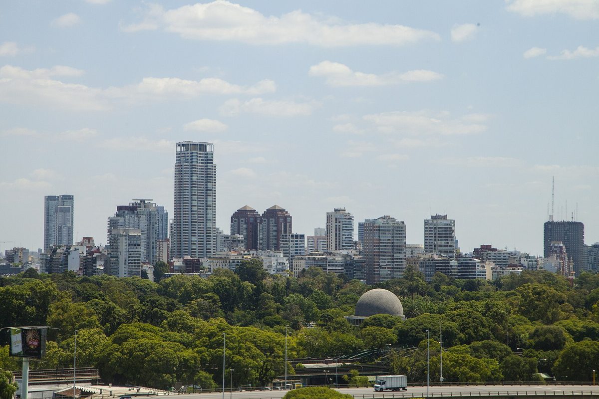
The North is where most travellers spend most of their time, and where the best hotels and restaurants sit. Running up the river side of the city, it takes in Palermo (huge, green and full of nightlife and design shops), elegant Recoleta with its French architecture and famous cemetery, leafy Belgrano, and riverside Núñez by the River Plate stadium. This is the safe, comfortable, slightly upscale Buenos Aires — the easiest place to land for a first trip.
Centre — the historic and business core
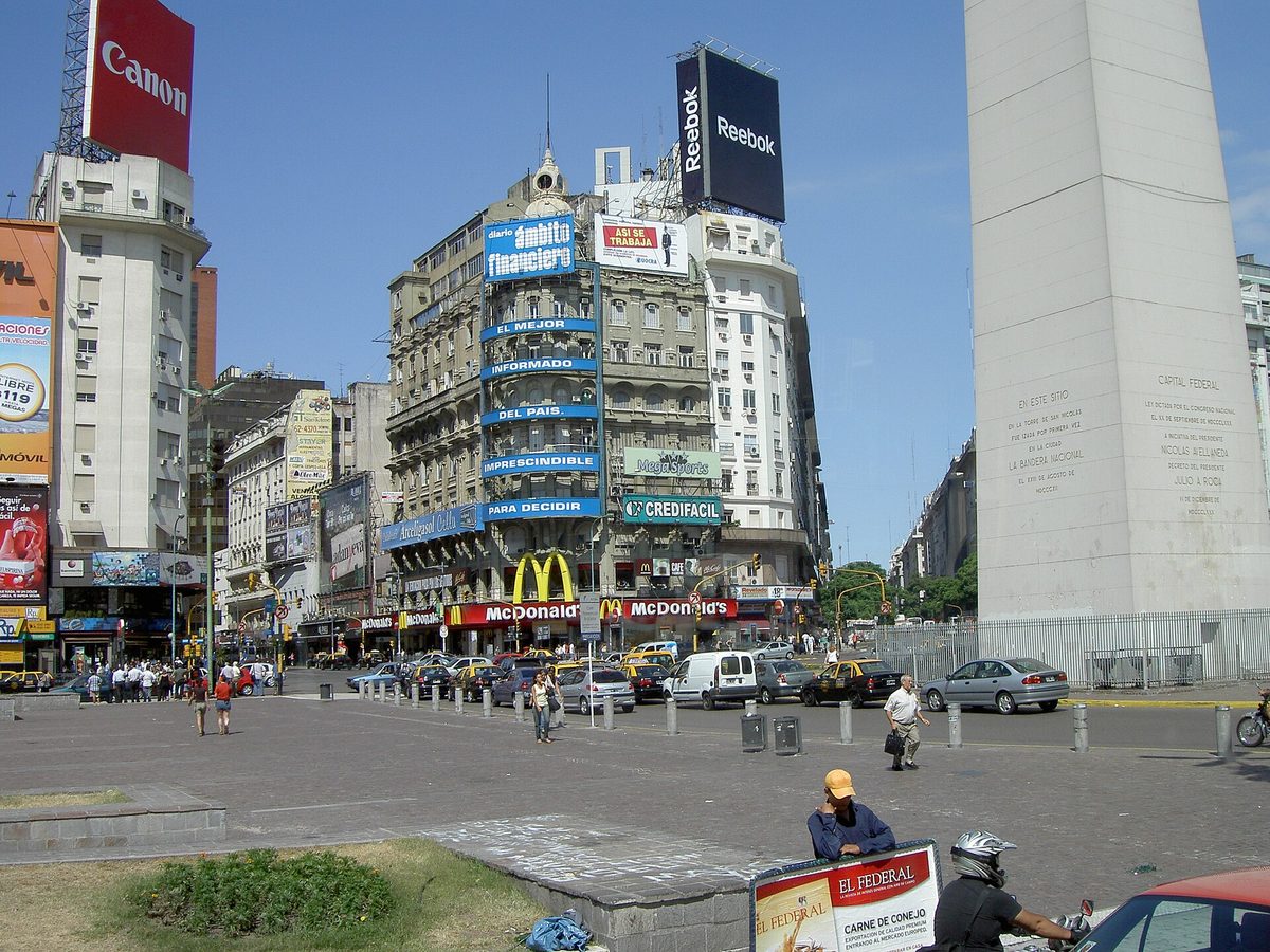
The Centre is the old downtown: the Microcentro (officially the barrio of San Nicolás) with the Obelisco and the banks, the government quarter of Monserrat around Plaza de Mayo, and the transport-hub barrio of Retiro to the north. Tacked onto its eastern edge is shiny Puerto Madero, the redeveloped docklands of glass towers and waterside restaurants. The Centre is busy and businesslike by day, much quieter at night, and packed with landmarks you will want to see.
South — the historic, bohemian, working-class zone
South of Plaza de Mayo the city gets older, lower and more atmospheric. San Telmo, with its cobblestones, antique market and Sunday tango, is the star, and colourful La Boca — home of the Caminito street and Boca Juniors — is its famous neighbour. Beyond the visited pockets, southern barrios such as Barracas are more working-class and patchier for tourists, so it pays to know which streets are the popular ones (more on that below).
West — the everyday, residential, local zone
Head inland, away from the river, and you reach the city most visitors never see: big residential barrios such as Caballito (geographic dead-centre of the city), hip and gritty Villa Crespo, the tango-and-cemetery barrio of Chacarita with neighbouring Colegiales, and lively Almagro. There are no must-see monuments here, but this is where you feel everyday porteño life, and a few pockets (the Villa Crespo–Palermo border, in particular) are quietly cool.
| Zone | Key barrios | What’s there | Best for |
|---|---|---|---|
| North | Palermo, Recoleta, Belgrano, Núñez | Parks, nightlife, design, top hotels, the cemetery | Most visitors — staying and dining |
| Centre | Microcentro (San Nicolás), Monserrat, Retiro, Puerto Madero | Obelisco, Plaza de Mayo, theatres, docklands | Sightseeing and landmarks |
| South | San Telmo, La Boca, Barracas | Cobblestones, antiques, tango, Caminito | History, atmosphere, day visits |
| West | Caballito, Villa Crespo, Chacarita, Colegiales, Almagro | Residential streets, local cafes, some nightlife | Living like a local, longer stays |
If you only remember one thing from this guide, make it this table. North and Centre cover the great majority of a typical first visit; South adds the historic, photogenic day trips; West is where you go to live a little more like a porteño. For a deeper ranking of which barrios suit which kind of traveller, see our guide to the best neighborhoods in Buenos Aires for tourists.
Using the Subte and the big avenues to orient yourself
Without a map graphic in hand, the quickest way to fix the city in your head is to hang it off two things: the Subte (metro) lines and a few giant avenues. Both run in roughly straight lines through the zones above, so they double as orientation rails.

The Subte has six numbered-and-lettered lines (A, B, C, D, E and H) that mostly fan out from the centre like spokes. Three are gold for visitors. Line D (green) is the tourist’s friend, threading the whole North zone from the centre up through Recoleta and Palermo to Belgrano. Line A (light blue), the oldest, runs west along Avenida de Mayo and Rivadavia. Line C (blue) runs north–south and links the two big train stations, Retiro and Constitución. Picture those three and you can picture how the zones connect.
The avenues are the other half of the trick. Avenida 9 de Julio — one of the widest in the world, crowned by the Obelisco — slices north–south through the centre. Avenida de Mayo runs west from Plaza de Mayo to the Congreso, linking the two big civic squares. And Avenida Rivadavia, the city’s baseline, runs dead west for kilometres and splits the grid into north and south — the key to reading addresses, as we will see next. Getting comfortable with the Subte map early pays off; our getting around Buenos Aires guide covers SUBE cards, fares and buses in detail.
How to read a Buenos Aires address
Porteño addresses look intimidating but follow a logical grid, and cracking the code makes the whole city easier to navigate. An address is almost always a street name plus a number — for example, the presidential palace is “Balcarce 50” — with the cross-street often given as well (“Corrientes y Callao” means the corner of those two streets; y is Spanish for “and”).

The numbers are not random. Across most of the city they count outward from a baseline — broadly, Avenida Rivadavia — rising by roughly 100 per block. So a low number (say, 300) is close to the centre, while a high one (3500) is well out in the barrios, letting you guess distances without a map. Street names also change as they cross Rivadavia, which is why one route can carry two names.
A few practical habits help. Always note the cross-street, since long avenues run for kilometres and the number alone can leave a taxi guessing. Save your hotel’s exact address and nearest corner offline before you arrive. And remember that house numbers and Subte stations are your two most reliable orientation tools when street signs are missing or hard to spot.
Which barrios matter most for visitors
You will not visit all 48 barrios, and you should not try. A first trip of a few days realistically touches a handful, almost all in the North and Centre, with a day or two dipping South. Here is the short list worth prioritising, roughly in order of how much visitor time they tend to absorb.
- Palermo — the biggest, greenest and most stay-able barrio; parks, restaurants, boutiques and nightlife. Read more in our Palermo guide.
- Recoleta — elegant, walkable and home to the celebrated cemetery and grand avenues; see our Recoleta guide.
- San Telmo — the bohemian old town with the Sunday market and tango; our San Telmo guide has the details.
- La Boca — the colourful Caminito and Boca Juniors, best as a daytime visit; our La Boca guide covers the safe streets.
- Microcentro & Puerto Madero — the landmark-dense core and the modern docklands; see Microcentro and Puerto Madero.
Where you actually sleep shapes the whole trip, so it is worth matching the zone to your style before you book. Our guide to where to base yourself breaks down the trade-offs neighbourhood by neighbourhood, and once you have a base sorted, our roundup of things to do in Buenos Aires will help you fill the days.

Practical tips for mapping the city in your head
- Think in four zones, not 48 names. North, Centre, South and West is all the framework you need to place any address quickly.
- Anchor on the Obelisco. It sits on Avenida 9 de Julio at the heart of the Centre, and almost everything is described as north, south or west of there.
- Let Subte Line D be your spine. It links the Centre to Recoleta, Palermo and Belgrano — the whole tourist North — in one straight run.
- Note the cross-street for every address. Avenues run for kilometres, so the corner matters as much as the number.
- Treat the South with a little care. Stick to the visited streets of San Telmo and the Caminito in La Boca, and avoid wandering far off them, especially after dark.
- Download an offline map before you arrive. The barrio boundaries are useful to have on your phone even though this guide leans on tables rather than a graphic.
Frequently asked questions
How many neighborhoods does Buenos Aires have?
The city of Buenos Aires has, officially, 48 barrios (neighbourhoods). Since 2008 these have also been grouped into 15 comunas for local government. As a visitor you navigate by the 48 named barrios — and, in practice, by an even simpler shortcut of four broad zones: North, Centre, South and West.
What are the main areas of Buenos Aires for tourists?
Most visitor time is spent in the North (Palermo, Recoleta, Belgrano) and the Centre (the Microcentro, Plaza de Mayo and Puerto Madero), with day trips into the historic South (San Telmo and La Boca). The residential West is where locals live but holds few headline sights, so it is more of a stay-like-a-local zone.
What is a comuna in Buenos Aires?
A comuna is an administrative unit of city government, created in 2008, that groups one or more adjoining barrios under a single elected board. There are 15 in total. Comunas matter mainly for local elections and official paperwork; as a traveller you will rarely need them, since you navigate by barrio and by zone instead.
Is Buenos Aires divided into north and south?
Loosely, yes. Porteños often speak of the wealthier, leafier North (Palermo, Recoleta, Belgrano) versus the older, more working-class South (San Telmo, La Boca, Barracas), split roughly around Plaza de Mayo. The street-numbering grid also uses Avenida Rivadavia as its north–south baseline, reinforcing the divide.
How do I read a Buenos Aires address?
An address is a street name plus a number, often with the nearest corner given too (“y” means “and”). Numbers climb outward from a central baseline by about 100 per block, so a low number is near the centre and a high one is out in the barrios. Always note the cross-street, as avenues run for kilometres.
Final thoughts
Buenos Aires looks daunting on paper — 48 barrios, 15 comunas, a grid that runs for kilometres — but it collapses into something simple the moment you think in four zones and hang them off the Obelisco, Avenida 9 de Julio and Subte Line D. Fix that framework in your head before you land and you will move around like you have been here for weeks. For the full neighbourhood-by-neighbourhood rundown and where to base yourself, head back to our complete guide to Buenos Aires neighborhoods, then line up the days with our roundup of the best things to do in Buenos Aires. Bienvenido — the city is more navigable than it looks.
Photo credits
- An aerial view over the parks and apartment towers of northern Buenos Aires — photo by Ricardo Patiño, CC BY-SA 2.0, via Wikimedia Commons.
- The Obelisco and Plaza de la República on the wide Avenida 9 de Julio in the city centre — photo by Alekino, public domain, via Wikimedia Commons.
- The glass towers and yacht marina of Puerto Madero on the eastern edge of downtown — photo by EncicloPaulo, CC BY-SA 4.0, via Wikimedia Commons.
- An aerial view of Plaza de Mayo and the pink Casa Rosada in the historic centre — photo by Pavel Špindler, CC BY 3.0, via Wikimedia Commons.
- A French-style avenue with a city colectivo bus in the Recoleta barrio — photo by Aleposta, public domain, via Wikimedia Commons.